Surveying
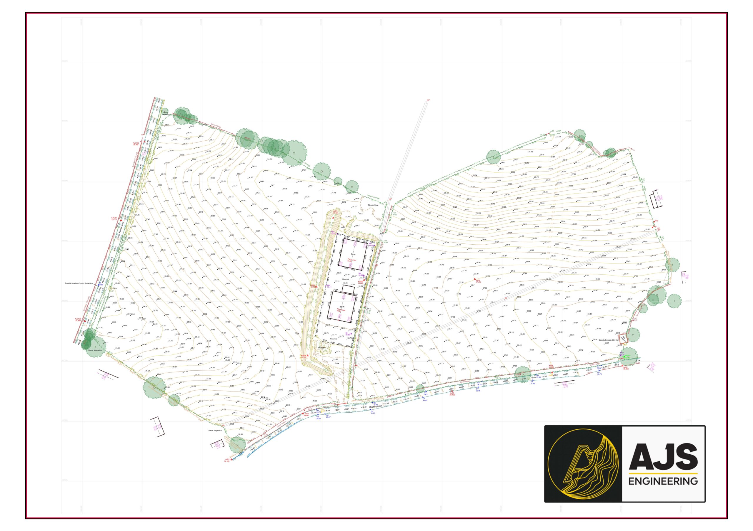
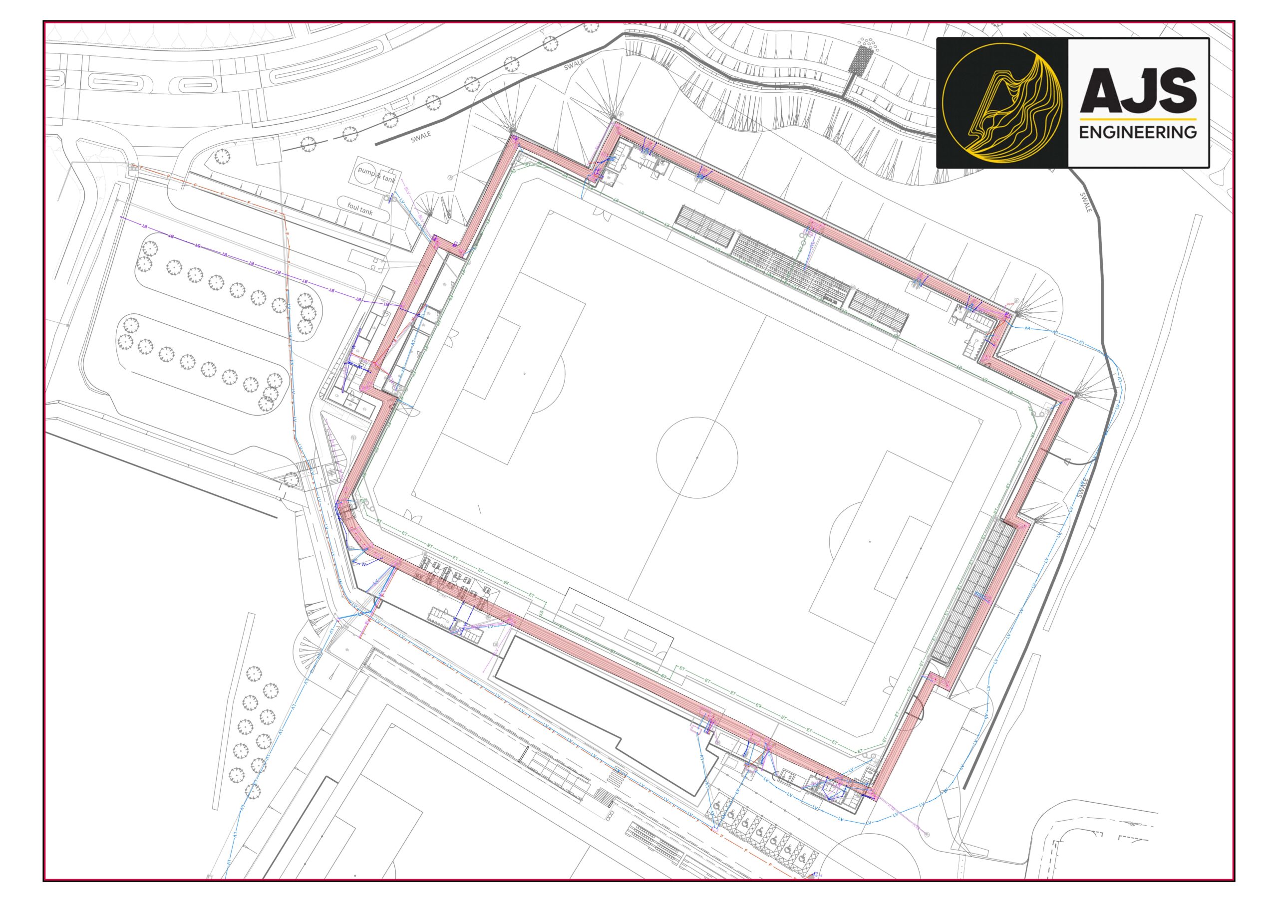
Topographic Surveys
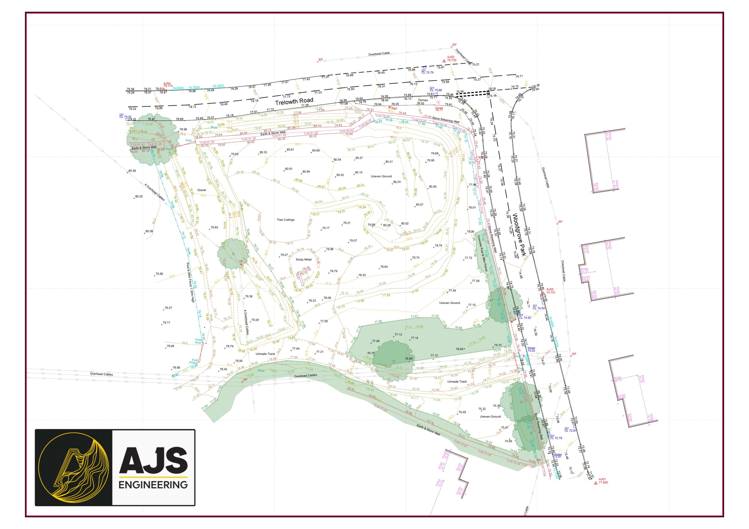
Accurate. Comprehensive. Designed for action.
Whether it’s greenfield land, urban development sites, or complex terrain, our topographic surveys provide the precision and clarity needed to inform every stage of your project. Delivered in clean, readable layers with all critical features captured — from boundaries and levels to trees, utilities, and structures.
What we offer:
High-resolution 2D & 3D deliverables
Fully layered DWG + PDF plans
Contours, levels, drainage, trees, overhead services, and more
Designed for engineers, planners, and designers
We’re actively growing in this space — ask us how we can support your next site.
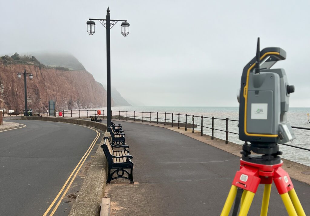
Modern Total Stations
With modern total stations we’re able to observe and record information otherwise inaccessible aswell as survey site features efficiently, accurately and robotically.
GPS Grid & Datum
Fully equipped with GPS we can provide surveys relative to OS National grid & level or a local/arbitrary grid & level, with elected datum references highlighted on the final drawing.
Engineering Surveys
Stay ahead of the chaos with clear, reliable data.
Engineering surveys play a vital — often invisible — role in guiding design decisions and managing change. At AJS Engineering, we deliver accurate, detailed feedback that keeps your site team informed and your programme moving.
Volumetric Surveys
We can compare original,existing & proposed ground levels to calculate volume measures and undertake simple stockpile surveys & measurements.
As-built surveys
We can take accurate measured surveys throughout the lifespan of your project, providing QA checks along the way. Surveys will generally be overlaid against the design for clear visual comparisons.
Detailed Line & Level Reports
For when you need a detailed look at the geometry of a built feature, we can provide survey reports with suitable tailored presentation.
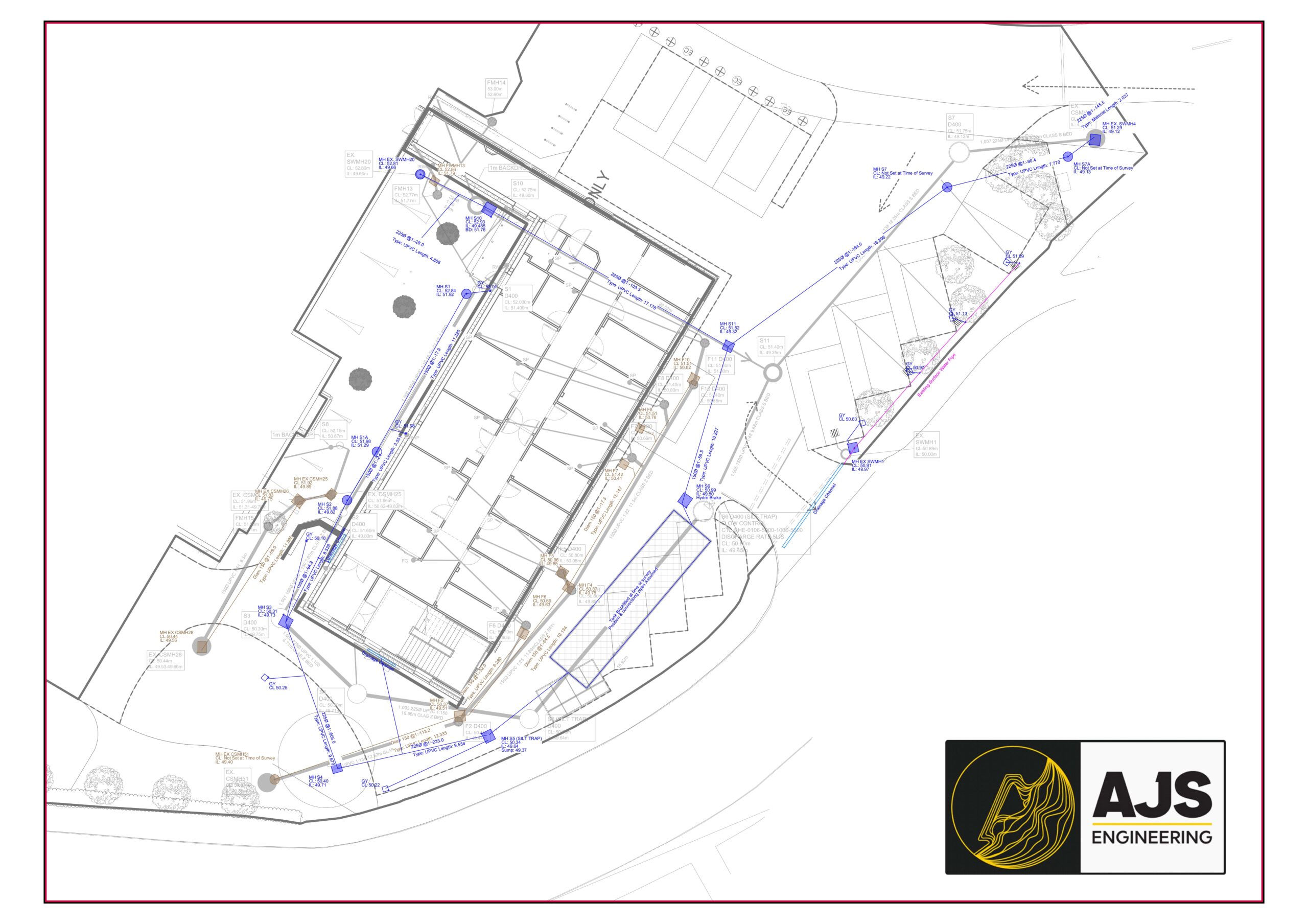
Underground Services As-builts
Get us in before you back fill it & by the end of your project you’ll have accurate records of your newly installed services.
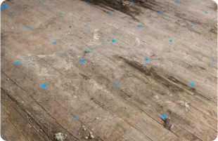
Precise level surveys
We can observe levels related to site datum or one of your choosing, tailored to your specification. These surveys can be presented as isopachyte models highlighting deviations to a desired plane.
Measured Building Surveys
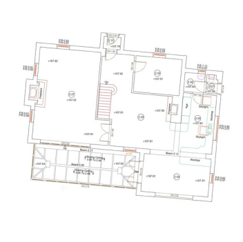
Floorplans
We have experience completing a vast array of different measured building projects, from listed buildings to modern buildings, disused hospitals to homes & hotels.
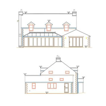
Elevations & Sections
Whether your project requires the measured elevations and sections of an intricately detailed and decorated building, or basic outline elevations of a featureless barn, we can adapt our methods to provide the most cost efficient solution without sacrificing the quality of the results.
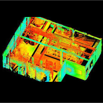
3D Scanning
By deploying high tech scanning equipment, we can capture a huge amount of information in a short space of time, providing minimum disruption to the client. Survey data can be processed in to plans and issued as DWGs or PDFs or registered point cloud data.